Severe Thunderstorm Alert for Spartanburg, Laurens, and Union Counties
Hey there, folks! If you’re in Southern Spartanburg, Laurens, or Union counties, listen up! The National Weather Service (NWS) has issued a severe thunderstorm alert that’s in effect until 7:15 p.m. this evening. So, it’s time to grab a cozy spot indoors and stay safe!
What’s Happening?
As of 6:31 p.m., Doppler radar picked up a strong thunderstorm moving its way through the area. This storm was located about 9 miles northeast of Laurens—or roughly 6 miles north of Clinton—and it’s zipping southeast at around 20 mph. Residents in nearby communities, including Clinton, Joanna, Cross Anchor, Sedalia, Kinards, Cross Keys, and Ora, are advised to be on high alert.
One of the biggest concerns with this thunderstorm is wind gusts that could reach up to 40 mph. It’s likely that these strong winds could knock down tree limbs and send unsecured items flying. So if you have things outside, it might be a good idea to bring them in now!
Local Impacts
The storm isn’t just bringing winds—it’s also delivering a hefty amount of rainfall. With the heavy downpour, there’s a chance of localized flooding. Always remember: if you see flooded roads, it’s best not to drive through them. It may seem like a small stream, but you never know how deep it actually is!
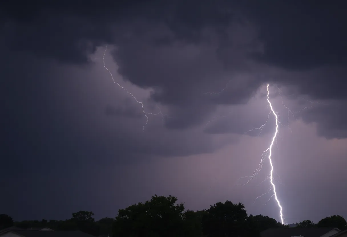
Safety First!
If you can, try to stay indoors until the storm passes. If you find yourself outside and unable to reach a building, please seek shelter as soon as possible. When thunderstorms are around, lightning is also a big concern. Every year, around 25 million lightning strikes occur in the U.S., primarily during the summer months, resulting in about 20 fatalities. So, let’s play it safe!
Understanding Hydroplaning
Now, let’s talk a bit about something that can happen when it pours: hydroplaning. This occurs when a vehicle starts sliding uncontrollably on wet roads. Essentially, when water in front of your tires collects faster than your car can push it aside, the car can rise up and glide on a thin layer of water between the tires and the road. Yikes!
Hydroplaning usually happens due to a combination of factors: your tire tread depth, the speed at which you’re driving, and how much standing water is on the road. If you find yourself hydroplaning, the best thing to do is to stay calm, take your foot off the gas, and steer straight until you regain control. Remember—panic can make the situation worse!
Let’s Stay Prepared!
Until next time, stay dry and keep your spirits high!


