News Summary
Residents of Columbia, South Carolina are on high alert as tornado warnings and severe thunderstorm alerts have been issued. The National Weather Service has warned of significant risks, including possible tornado sightings and damaging winds. Communities are preparing for localized flash flooding and power outages due to potential storm damage. A confirmed EF-1 tornado touched down, although thankfully without injuries. As weather conditions improve in the coming days, locals are reminded to remain vigilant and prepared for unpredictable weather patterns.
Columbia Residents Brace for Storms: Tornado Warnings and Severe Weather Alerts Issued
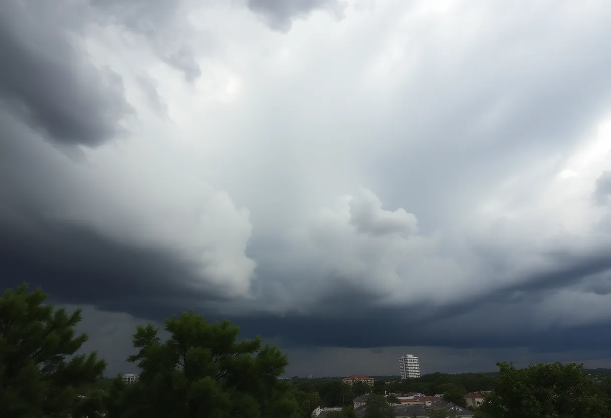
This past Sunday morning was anything but calm for residents of Columbia, South Carolina. The air was thick with apprehension as the National Weather Service issued severe thunderstorm and tornado warnings for the area. With weather forecasters keeping a close eye, it was clear that Columbia was in for a bumpy ride.
Warnings for Thunderstorms and Tornadoes
The tornado warning rang out, effective until 8:15 a.m., while the severe thunderstorm warning lasted until 8:30 a.m.. Even with these warnings set to expire, meteorologists alerted locals that the risk for severe weather was far from over, stretching well into the afternoon. Citizens were advised to stay vigilant, with potential storms expected until around 3 p.m..
A Tornado Watch in Effect
Adding to the weather woes, a tornado watch was issued and remained in effect until 2 p.m. Both Richland County and Lexington County found themselves caught in the storm’s grasp, but they weren’t alone. Nearly all of the surrounding Midlands area, including counties like Kershaw, Sumter, Calhoun, Clarendon, Lee, and Orangeburg, were also under watch.
Reports of a Tornado
Storm Risks Beyond Tornadoes
As if tornadoes weren’t enough to worry about, locals were also on high alert for strong-to-severe thunderstorms, which could cause localized flash flooding and additional gusty winds. With a strong cold front barreling through the area, the potential for significant damage loomed large. Residents were cautioned that powerful winds could wreak havoc on trees, mobile homes, roofs, and outbuildings. Even vehicles were at risk should a tornado touch down nearby!
Power Outages and Warnings
Damage to trees and branches has the potential to knock down power lines, leading to outages for many residents. Furthermore, a lake wind advisory was issued for the entire Midlands area, warning small craft operators of hazardous conditions. Rough waves were predicted on local lakes, with winds gusting at speeds of up to 40 mph.
Rainfall Predictions
With a 90% chance of rain hitting Columbia on Sunday, residents were advised to prepare for possible rain amounts of up to half an inch—and localized amounts that could be even higher. It was certainly a day to stay indoors and watch the weather unfold!
What’s Next for Columbia?
Following the chaotic weather on Sunday, things are expected to shift dramatically in the coming days. Conditions are predicted to dry up and warm, with temperatures climbing from highs in the 60s to a possible peak of 78 degrees by Wednesday. Just when you thought spring was finally on its way!
A Confirmed EF-1 Tornado
Stay Prepared
As Columbia gazes into the horizon, ready for brighter weather, residents are reminded to stay prepared. We never know when nature might throw us a curveball. Whether it’s just a rainy Sunday or a chaotic tornado, it’s best to be informed and ready to weather any storm!
Deeper Dive: News & Info About This Topic
HERE Resources
Severe Thunderstorm Warnings Drizzle Down on Charleston
Severe Thunderstorm and Tornado Warnings for Columbia
Rock Hill Faces Havoc as Severe Thunderstorm Strikes
Winter Weather Advisory Issued for Columbia Area
Winter Weather Warning Issued for Columbia, SC
Thunderstorm Warning Issued for Coastal Jasper County
Snowstorm Hits Columbia, South Carolina: Schools Close, Roads Icy
South Carolina Residents Receive Disaster Assistance After Storms
Winter Storm Threatens South Carolina: Snow and Cold Weather Ahead for Columbia
Winter Storm Cora Brings Heavy Snow and Ice Across the South
Additional Resources
- The State: Weather News
- Wikipedia: Tornado
- WIS TV: Confirmed Tornado near Chapin
- Google Search: South Carolina Weather Alerts
- WLTX: Lake Murray Tornado Damage
- Encyclopedia Britannica: Tornado
- KRCG TV: Rolla Tornado Response
- Google News: Missouri Tornado Responses
- Columbia Missourian: Storm Damage Response
- Google Scholar: Tornado Impact on Communities