News Summary
Orangeburg, SC is under severe thunderstorm warnings as the National Weather Service predicts strong thunderstorms with winds up to 60 mph and potential for hail. Residents in affected areas including Central Orangeburg and surrounding counties are urged to seek shelter and remain cautious. The storms are anticipated to produce dangerous conditions including lightning and hydroplaning risks. A Tornado Watch is also in effect, emphasizing the urgency for safety precautions until the storm passes.
Severe Thunderstorm Warnings Hit South Carolina
Orangeburg, SC is bracing itself as a series of thunderstorm warnings were issued by the National Weather Service (NWS) Columbia. On Monday, the weather alert was updated at 7:02 p.m., indicating that strong thunderstorms are expected to linger until 7:45 p.m. The affected areas include Central Orangeburg, Southeastern Orangeburg, Calhoun, Clarendon, and Bamberg counties.
Let’s Talk Winds!
Doppler radar has picked up some serious thunderstorms, which were spotted about 7 miles southwest of Orangeburg County Airport. These storms are sweeping east at a brisk pace of 50 mph. With wind gusts predicted to reach as high as 50 mph, it’s vital for residents to be cautious. Winds of this magnitude could cause tree limbs to come crashing down and send unsecured objects flying.
Locations on the Radar
Residents can expect storm activity in several key locations. Areas like Bowman, Poplar Creek Landing, Rowesville, Vance, Ehrhardt, Santee State Park, and many more are in the storm’s path. Notable highways affected include Interstate 26 between mile markers 152 and 169 and Interstate 95 between mile markers 85 and 110.
Safety First!
If you find yourself outdoors, it’s time to head indoors. The NWS recommends looking for shelter, especially if you’re near **Lake Marion**. Remember, lightning can strike as far as 10 miles away from the heart of a thunderstorm. A Tornado Watch was also issued and will be in effect until 8 p.m. for central South Carolina, heightening the urgency.
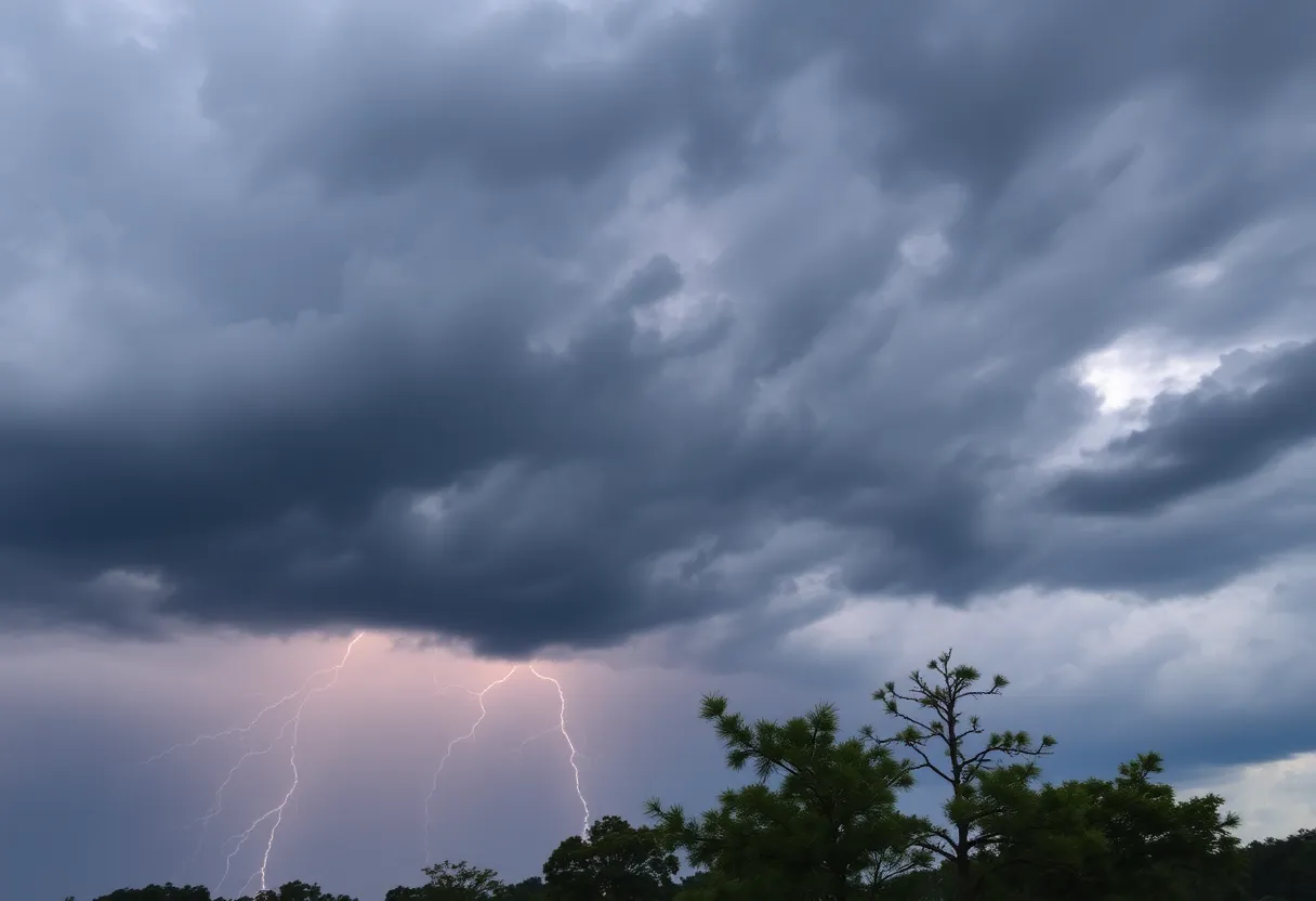
The Lightning Factor
Did you know that approximately 25 million lightning strikes occur across the U.S. every year? Unfortunately, they result in about 20 fatalities annually. As a storm rolls in, the chances of lightning increase significantly, peaking when the storm is directly overhead. Staying safe should be everyone’s top priority.
Driving Precautions
For those planning to travel, keep in mind the risk of hydroplaning. This happens when there’s too much water on the road, causing a vehicle to slide uncontrollably. The NWS has pointed out the top three causes of hydroplaning—be alert if you’re on the roads!
More Than Just Thunder and Wind
The earlier warning, issued at 6:01 p.m., already predicted the potential for quarter-sized hail and winds gusting up to 60 mph. Several areas previously affected include Entaw Springs, Indian Bluff Recreation Park, and even Santee Cooper Regional Airport. Damage to vehicles due to hail was reported, emphasizing the seriousness of the situation.
What to Expect Next?
As the storm system makes its way toward the coast, it is expected to weaken; however, winds could still stretch up to 60 mph, posing travel hazards, especially on bridges. A First Alert Weather Day has been declared, with storms rated at a Level 3 of 5 by the Storm Prediction Center. This means the threat is very real, and folks should remain vigilant.
Final Thoughts
Stay indoors, keep your loved ones safe, and catch up on your favorite shows until this storm passes. Follow the guidelines provided by the NWS for staying safe during a thunderstorm, whether you’re indoors or unexpectedly caught outside. Let’s hope the skies clear soon!
Deeper Dive: News & Info About This Topic
HERE Resources
Severe Weather Alert: Thunderstorms Impact Upstate SC and Georgia
Severe Thunderstorm and Tornado Watches Hit South Carolina
Tragic Loss: Community Mourns 9-Year-Old Boy Swept Away by Floods
Severe Weather Hits Columbia: Tornado and Thunderstorm Warnings
Thunderstorm Warning for Western North Carolina
Rock Hill Residents Brace for Severe Weather as Memories of Past Storm Resurface
York County Residents Brace for Severe Weather
Severe Weather Warnings Issued for Columbia and Lexington Counties
Columbia Braces for Severe Weather as Storms Approach
Wildfire in York County, SC Fully Contained
Additional Resources
- Herald Online
- Wikipedia: Thunderstorm
- Myrtle Beach Online
- Google Search: Thunderstorm Safety
- Live 5 News
- Google Scholar: Severe Thunderstorms
- WIS TV
- Encyclopedia Britannica: Thunderstorm
- The State
- Google News: Severe Weather Alerts